Geolocate

Montan Mayo topographic map

Click on the map to display elevation.

About this map

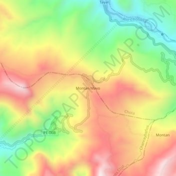
Name: Montan Mayo topographic map, elevation, terrain.

Location: Montan Mayo, Chancaybaños, Santa Cruz, Cajamarca, Perú (-6.57583 -78.81209 -6.53583 -78.77209)

Average elevation: 2,362 m

Minimum elevation: 1,989 m

Maximum elevation: 2,733 m

Other topographic maps

Click on a map to view its topography, its elevation and its terrain.

Chancaybaños

Perú > Cajamarca > Chancaybaños

Average elevation: 2,054 m

Gear up for your next adventure:

🔭Outdoor Binoculars - Lightweight binoculars for birdwatching and hiking
👟Leg Gaiters - Keep debris, mud, and snow out of your boots
🧰Multitool Knife - Compact and versatile tool for outdoor use
🛶Canoe Life Vest - Safety vest for water sports
Camping Essentials - All-in-one gear for a comfortable camping trip

As an Amazon Associate, this site earns from qualifying purchases at no extra cost to you.