Geolocate

Andover topographic map

Click on the map to display elevation.

About this map

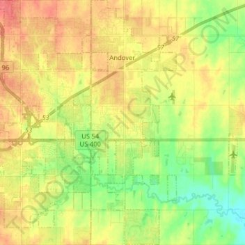
Name: Andover topographic map, elevation, terrain.

Location: Andover, Butler County, Kansas, United States (37.63588 -97.15331 37.73781 -97.10782)

Average elevation: 406 m

Minimum elevation: 379 m

Maximum elevation: 430 m

Other topographic maps

Click on a map to view its topography, its elevation and its terrain.

Prospect

United States > Kansas > Butler County

Average elevation: 417 m

Gear up for your next adventure:

🧼Biodegradable Camp Soap - Environmentally friendly cleaning for gear and body
🪑Insulated Seat Pad - Protect your seat from cold rocks and wet logs
🧴Bear Spray Holster - Quick-access carry for essential Canadian wilderness safety
🧢Sun Protection Cap - Breathable cap to protect from sun exposure
🧴Waterproofing Spray - Restore the DWR coating on jackets and tents

As an Amazon Associate, this site earns from qualifying purchases at no extra cost to you.