Geolocate

Arnes topographic map

Click on the map to display elevation.

About this map

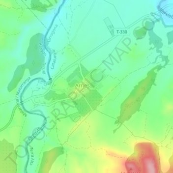
Name: Arnes topographic map, elevation, terrain.

Location: Arnes, Terra Alta, Tarragona, Catalonia, 43597, Spain (40.90786 0.25386 40.91385 0.26517)

Average elevation: 487 m

Minimum elevation: 438 m

Maximum elevation: 595 m

Gear up for your next adventure:

Camping Coffee Maker - Brew fresh coffee anywhere on the topographic map
🧊Insulated Water Bottle - Keeps drinks cold in summer and prevents freezing in winter
🧰Emergency Multi-Tool - Compact multi-tool for outdoor survival
🥾Mountaineering Boots - Supportive boots for climbing and high-altitude hiking
🔦UV Flashlight - Detect minerals or specific insects in the dark

As an Amazon Associate, this site earns from qualifying purchases at no extra cost to you.