Geolocate

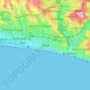
BN2 4PG topographic map

Click on the map to display elevation.

About this map

Name: BN2 4PG topographic map, elevation, terrain.

Location: BN2 4PG, Coldean, Brighton, Brighton and Hove, England, BN2 4PG, United Kingdom (50.85442 -0.10316 50.85634 -0.09896)

Average elevation: 93 m

Minimum elevation: 27 m

Maximum elevation: 177 m

Other topographic maps

Click on a map to view its topography, its elevation and its terrain.

Fiveways

United Kingdom > England > Brighton and Hove > Brighton

Average elevation: 69 m

Hove

United Kingdom > England > Brighton and Hove > Brighton

Average elevation: 35 m

Gear up for your next adventure:

⛺Lightweight Camping Tent - Portable shelter optimized for Canadian backcountry camping
🔋Solar Power Bank - Keep your GPS and devices charged during long outdoor trips
🧴Bear Spray Holster - Quick-access carry for essential Canadian wilderness safety
⛺Camping Tent - Weather-resistant tents suitable for 2 to 6 people
🗺️Topographic Maps - Detailed maps to explore trails, mountains, and wilderness areas

As an Amazon Associate, this site earns from qualifying purchases at no extra cost to you.