
Bukit Naga topographic map
Click on the map to display elevation.
About this map
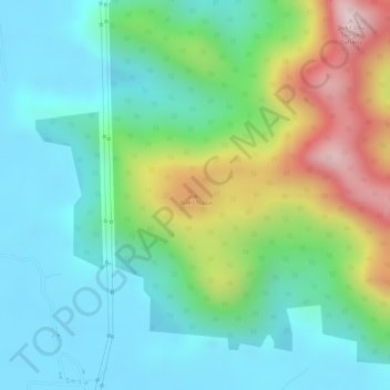
Name: Bukit Naga topographic map, elevation, terrain.
Location: Bukit Naga, Larut, Matang and Selama, Perak, Malaysia (4.58509 100.70596 4.58519 100.70606)
Average elevation: 138 m
Minimum elevation: 2 m
Maximum elevation: 443 m
Other topographic maps
Click on a map to view its topography, its elevation and its terrain.
Proposed Aboriginal Area Reserve of Chinggong (Jernang)
Malaysia > Perak > Kampung Behrang Ulu
Average elevation: 74 m