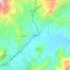
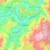
Aquitania topographic map
Click on the map to display elevation.
Aquitania
Aquitania is a town and municipality in Boyacá Department, Colombia, part of the Sugamuxi Province, a subregion of Boyaca. Aquitania borders Sogamoso, Cuítiva and Mongua in the north, Zetaquirá, San Eduardo and Páez in the south, Labranzagrande, Pajarito, Recetor and Chámeza in the east and Cuítiva, Tota, Zetaquirá and San Eduardo in the west. The urban centre is situated on the Altiplano Cundiboyacense as one of the highest towns at an altitude of 3,030 metres (9,940 ft). The town of Aquitania borders Lake Tota to the east.
About this map
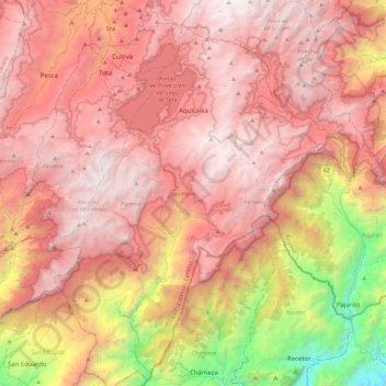
Name: Aquitania topographic map, elevation, terrain.
Average elevation: 2,595 m
Minimum elevation: 545 m
Maximum elevation: 3,904 m
Other topographic maps
Click on a map to view its topography, its elevation and its terrain.

Tunja
Tunja has a population of 172,548 inhabitants according to the 2018 Census. 0.1% of the city is indigenous, 0.4% is black, and 99.5% is white and Mestizo. It is located in central Colombia, at an elevation ranging from approximately 2,700 metres (8,900 ft) to 2,900 metres (9,500 ft). The city centre is at an…
Average elevation: 2,824 m
Cordillera Oriental
The Cordillera Oriental montane forests ecoregion covers the eastern slopes of the cordillera and its northern end. The Magdalena Valley montane forests cover the western slopes. The Northern Andean páramo covers the highest elevations.
Average elevation: 4,825 m
Sogamoso
Sogamoso (Spanish pronunciation: [soɣaˈmoso]) is a city in the department of Boyacá of Colombia. It is the capital of the Sugamuxi Province, named after the original Sugamuxi. Sogamoso is nicknamed "City of the Sun", based on the original Muisca tradition of pilgrimage and adoring their Sun god Sué at the…
Average elevation: 2,901 m