Geolocate

Maco topographic map

Click on the map to display elevation.

About this map

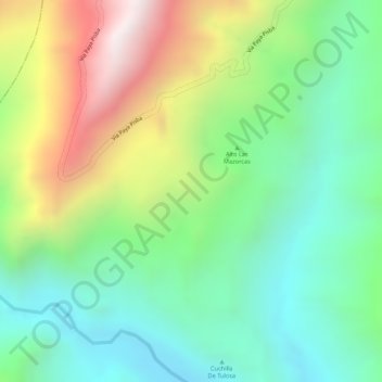
Name: Maco topographic map, elevation, terrain.

Location: Maco, Paya, La Libertad, Boyacá, Colombia (5.66007 -72.46890 5.68007 -72.44890)

Average elevation: 1,217 m

Minimum elevation: 904 m

Maximum elevation: 1,725 m

Gear up for your next adventure:

🛏️Sleeping Bag - Warm and compact sleeping bags for outdoor camping
🧴First Aid Kit - Essential first aid supplies for outdoor emergencies
🥾All-Terrain Hiking Boots - Versatile boots for varied hiking conditions
🧥Ultralight Puffy Jacket - Maximum warmth that packs down to the size of an orange
🛌Down Sleeping Bag - Superior warmth-to-weight ratio for cold nights

As an Amazon Associate, this site earns from qualifying purchases at no extra cost to you.