
Lacey topographic map
Interactive map
Click on the map to display elevation.
About this map
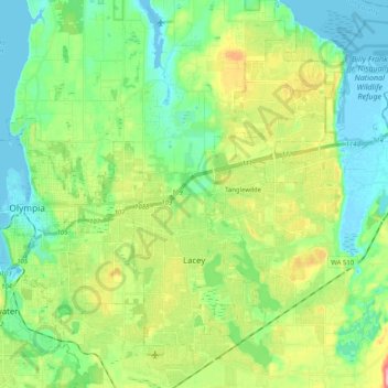
Name: Lacey topographic map, elevation, terrain.
Location: Lacey, Thurston County, Washington, United States (46.98048 -122.83914 47.11930 -122.73825)
Average elevation: 47 m
Minimum elevation: -3 m
Maximum elevation: 152 m
Other topographic maps
Click on a map to view its topography, its elevation and its terrain.