Geolocate

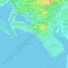
Tando Ghulam Ali topographic map

Click on the map to display elevation.

About this map

Name: Tando Ghulam Ali topographic map, elevation, terrain.

Location: Tando Ghulam Ali, Badin, Sindh, 72200, Pakistan (25.08298 68.85052 25.16298 68.93052)

Average elevation: 15 m

Minimum elevation: 11 m

Maximum elevation: 18 m

Other topographic maps

Click on a map to view its topography, its elevation and its terrain.

SITE Town

Pakistan > Sindh > Karachi Division

Average elevation: 38 m

PECHS Block 6

Pakistan > Sindh > Karachi Division > Jamshed Town

Average elevation: 18 m

Karachi Division

Pakistan > Sindh

Karachi lies very close to a major fault line, where the Indian tectonic plate meets the Arabian tectonic plate. However, Karachi lies near the western edge of the Indian Plate, on the Indo Gangetic Plain. Within the city of Karachi are two small ranges: the Khasa Hills and Mulri Hills, which lie in the…

Average elevation: 89 m

DHA Phase 5

Pakistan > Sindh > Karachi Division > Saddar Town

Average elevation: 9 m

Sandspit

Pakistan > Sindh > Karachi Division > Keamari Town

Average elevation: 1 m

Ibrahim Hyderi

Pakistan > Sindh

Average elevation: 7 m

Lyari Town

Pakistan > Sindh > Karachi Division

Average elevation: 7 m

Shah Faisal Town

Pakistan > Sindh > Karachi Division

Average elevation: 20 m

Manghopir Town

Pakistan > Sindh > Karachi Division

Average elevation: 60 m

Memon Goth

Pakistan > Sindh > Karachi Division

Average elevation: 42 m

Karachi Division

Pakistan > Sindh

Karachi lies very close to a major fault line, where the Indian tectonic plate meets the Arabian tectonic plate. Within the city of Karachi are two small ranges: the Khasa Hills and Mulri Hills, which lie in the northwest and act as a barrier between North Nazimabad and Orangi. Karachi's hills are barren and…

Average elevation: 89 m

Hill Park

Pakistan > Sindh > Karachi Division > Jamshed Town

Average elevation: 25 m

Orangi Town

Pakistan > Sindh > Karachi Division

Average elevation: 63 m

Sindhri Taluka

Pakistan > Sindh > Mirpur Khas District

Average elevation: 16 m

Bahria

Pakistan > Sindh > Karachi

Average elevation: 145 m

North Nazimabad Town

Pakistan > Sindh

Average elevation: 45 m

Indus River

Pakistan > Sindh > Sukkur

Average elevation: 64 m

Mirpur Sakro Taluka

Pakistan > Sindh > Thatta District

Average elevation: 14 m

Thatta District

Pakistan > Sindh

Average elevation: 43 m

Parchhi Ji Veri

Pakistan > Sindh > Umerkot District

Average elevation: 35 m

Karachi Division

Pakistan > Sindh

Karachi lies very close to a major fault line, where the Indian tectonic plate meets the Arabian tectonic plate. However, Karachi lies near the western edge of the Indian Plate, on the Indo Gangetic Plain. Within the city of Karachi are two small ranges: the Khasa Hills and Mulri Hills, which lie in the…

Average elevation: 89 m

Sehwan

Pakistan > Sindh > Jamshoro District

Average elevation: 37 m

Nagarparkar

Pakistan > Sindh > Tharparkar District

Average elevation: 98 m

Bin Qasim Town

Pakistan > Sindh > Karachi Division

Average elevation: 45 m

Karachi Division

Pakistan > Sindh

Karachi lies very close to a major fault line, where the Indian tectonic plate meets the Arabian tectonic plate. However, Karachi lies near the western edge of the Indian Plate, on the Indo Gangetic Plain. Within the city of Karachi are two small ranges: the Khasa Hills and Mulri Hills, which lie in the…

Average elevation: 89 m

Saddar Town

Pakistan > Sindh > Karachi Division

Average elevation: 4 m

Manghopir Town

Pakistan > Sindh > Karachi Division

Average elevation: 60 m

Digri Taluka

Pakistan > Sindh > Mirpur Khas District

Average elevation: 12 m

Orangi Town

Pakistan > Sindh > Karachi Division

Average elevation: 63 m

Guddu Barrage

Pakistan > Sindh > Kashmore District > Guddu

Average elevation: 77 m

DHA Phase 8

Pakistan > Sindh > Karachi Division > Saddar Town

Average elevation: 3 m

Karachi Division

Pakistan > Sindh

Karachi lies very close to a major fault line, where the Indian tectonic plate meets the Arabian tectonic plate. However, Karachi lies near the western edge of the Indian Plate, on the Indo Gangetic Plain. Within the city of Karachi are two small ranges: the Khasa Hills and Mulri Hills, which lie in the…

Average elevation: 89 m

Lyari Town

Pakistan > Sindh > Karachi Division

Average elevation: 7 m

Gulistan e Johar

Pakistan > Sindh > Gulistan-e-Jauhar

Average elevation: 39 m

Korangi Town

Pakistan > Sindh > Karachi Division

Average elevation: 8 m

Gulshan-e-Hadeed

Pakistan > Sindh > Karachi Division

Average elevation: 54 m

Malir River

Pakistan > Sindh > Karachi

Average elevation: 11 m

Hab River

Pakistan > Sindh > Karachi Division

Average elevation: 21 m

Keamari Town

Pakistan > Sindh > Karachi Division

Average elevation: 2 m

Saddar Town

Pakistan > Sindh > Karachi Division

Average elevation: 4 m

Karachi Division

Pakistan > Sindh

Karachi lies very close to a major fault line, where the Indian tectonic plate meets the Arabian tectonic plate. However, Karachi lies near the western edge of the Indian Plate, on the Indo Gangetic Plain. Within the city of Karachi are two small ranges: the Khasa Hills and Mulri Hills, which lie in the…

Average elevation: 89 m

Saddar Town

Pakistan > Sindh > Karachi Division

Average elevation: 4 m

Bin Qasim Town

Pakistan > Sindh > Karachi Division

Average elevation: 45 m

Mominabad Town

Pakistan > Sindh > Karachi Division

Average elevation: 59 m

Gulberg Town

Pakistan > Sindh > Karachi Division

Average elevation: 36 m

Korangi Town

Pakistan > Sindh > Karachi Division

Average elevation: 8 m

Mauripur Town

Pakistan > Sindh > Karachi Division

Average elevation: 10 m

Saddar Town

Pakistan > Sindh > Karachi Division

Average elevation: 4 m

SITE Town

Pakistan > Sindh > Karachi Division

Average elevation: 38 m

Keamari Town

Pakistan > Sindh > Karachi Division

Average elevation: 2 m

Jamshed Town

Pakistan > Sindh > Karachi Division

Average elevation: 20 m

Manghopir Town

Pakistan > Sindh > Karachi Division

Average elevation: 60 m

Karachi Division

Pakistan > Sindh

Karachi lies very close to a major fault line, where the Indian tectonic plate meets the Arabian tectonic plate. However, Karachi lies near the western edge of the Indian Plate, on the Indo Gangetic Plain. Within the city of Karachi are two small ranges: the Khasa Hills and Mulri Hills, which lie in the…

Average elevation: 89 m

PECHS Block 3

Pakistan > Sindh > Jamshed Town

Average elevation: 30 m

Keamari Town

Pakistan > Sindh > Karachi Division

Average elevation: 2 m

Karachi Division

Pakistan > Sindh

Karachi lies very close to a major fault line, where the Indian tectonic plate meets the Arabian tectonic plate. However, Karachi lies near the western edge of the Indian Plate, on the Indo Gangetic Plain. Within the city of Karachi are two small ranges: the Khasa Hills and Mulri Hills, which lie in the…

Average elevation: 89 m

Hala

Pakistan > Sindh > Matiari District

Average elevation: 27 m

New Karachi Town

Pakistan > Sindh > Karachi Division

Average elevation: 56 m

72200

Pakistan > Sindh > Badīn District

Average elevation: 11 m

DHA Phase 4

Pakistan > Sindh > Defence

Average elevation: 12 m

Chil

Pakistan > Sindh > Umerkot District

Average elevation: 17 m

Baldia Town

Pakistan > Sindh > Karachi Division

Average elevation: 40 m

بدين

Pakistan > Sindh > Badīn District

Average elevation: 9 m

Kharadar

Pakistan > Sindh > Karachi Division > Lyari Town

Average elevation: 7 m

Bagh-e-Jinnah

Pakistan > Sindh > Karachi Division > Lyari Town

Average elevation: 10 m

Karachi Division

Pakistan > Sindh

Karachi lies very close to a major fault line, where the Indian tectonic plate meets the Arabian tectonic plate. However, Karachi lies near the western edge of the Indian Plate, on the Indo Gangetic Plain. Within the city of Karachi are two small ranges: the Khasa Hills and Mulri Hills, which lie in the…

Average elevation: 89 m

Canal Road

Pakistan > Sindh > Mirpur Sakro Tehsil

Average elevation: 8 m

Sujawal

Pakistan > Sindh > Sujawal

Average elevation: 9 m

Indus River (branch)

Pakistan > Sindh > Sukkur District > Sukkur

Average elevation: 61 m

Gear up for your next adventure:

🥫Freeze-Dried Meals - Lightweight, high-calorie nutrition for multi-day treks
🩹Moleskin Blister Pads - Direct protection for painful foot pressure points
⛺Camping Groundsheet - Protect your tent from moisture and dirt
🧭GPS Outdoor Watch - Smart watch for navigation and fitness tracking in nature
🕶️Polarized Sunglasses - Protect your eyes with durable polarized lenses

As an Amazon Associate, this site earns from qualifying purchases at no extra cost to you.