Geolocate

Saddar Town topographic map

Click on the map to display elevation.

About this map

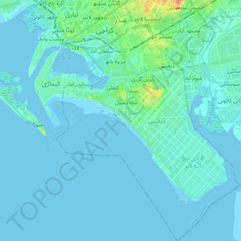
Name: Saddar Town topographic map, elevation, terrain.

Location: Saddar Town, Karachi South District, Sindh, Pakistan (24.72351 66.98739 24.87276 67.11269)

Average elevation: 4 m

Minimum elevation: -5 m

Maximum elevation: 41 m

Gear up for your next adventure:

🔋Lithium AA Batteries - Long-lasting power that performs in extreme cold
🧤Insulated Winter Gloves - Heavy-duty protection for sub-zero Canadian adventures
📷Outdoor Action Camera - Capture high-elevation views and rugged adventures
🧥Waterproof Pants - Keep dry during rainy hiking conditions
🥫Freeze-Dried Meals - Lightweight, high-calorie nutrition for multi-day treks

As an Amazon Associate, this site earns from qualifying purchases at no extra cost to you.