Geolocate

Murgash topographic map

Click on the map to display elevation.

About this map

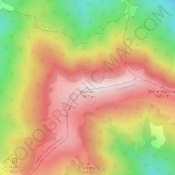
Name: Murgash topographic map, elevation, terrain.

Location: Murgash, Kremikovci, Sofia City, Sofia-City, Bulgaria (42.83298 23.66845 42.83308 23.66855)

Average elevation: 1,408 m

Minimum elevation: 1,056 m

Maximum elevation: 1,682 m

Gear up for your next adventure:

🧦Hiking Socks - Moisture-wicking and comfortable socks for long hikes
🦶Anti-Blister Balm - Prevents friction and hotspots during long ascents
👖Convertible Hiking Pants - Zip-off legs to adapt to changing weather conditions
🩹Moleskin Blister Pads - Direct protection for painful foot pressure points
💡Compact LED Flashlight - Powerful and portable flashlight for outdoor use

As an Amazon Associate, this site earns from qualifying purchases at no extra cost to you.