Geolocate

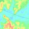
Michie topographic map

Click on the map to display elevation.

About this map

Name: Michie topographic map, elevation, terrain.

Location: Michie, McNairy County, West Tennessee, Tennessee, 38357, United States (35.02297 -88.46638 35.07661 -88.37749)

Average elevation: 150 m

Minimum elevation: 124 m

Maximum elevation: 192 m

Other topographic maps

Click on a map to view its topography, its elevation and its terrain.
Leapwood

United States > Tennessee > McNairy County

Average elevation: 157 m

Acton

United States > Tennessee > McNairy County

Average elevation: 146 m

Cypress

United States > Tennessee > McNairy County

Average elevation: 132 m

Gear up for your next adventure:

💡LED Camping Lantern - Illuminate your campsite with long-lasting lanterns
🔋Solar Power Bank - Keep your GPS and devices charged during long outdoor trips
🪑Ultralight Camping Stool - Compact seating for rest stops during long hikes
🧊Portable Cooler - Keep food and drinks cold during outdoor adventures
🧢Sun Hat - Wide-brim hat for sun protection

As an Amazon Associate, this site earns from qualifying purchases at no extra cost to you.