
Thank you for supporting this site ❤️
Make a donation
Make a donation
Gear up for your next adventure:
As an Amazon Associate, this site earns from qualifying purchases at no extra cost to you.
Bielsa topographic map
Click on the map to display elevation.
Thank you for supporting this site ❤️
Make a donation
Make a donation
Gear up for your next adventure:
As an Amazon Associate, this site earns from qualifying purchases at no extra cost to you.
About this map
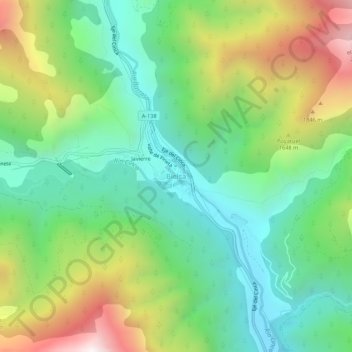
Name: Bielsa topographic map, elevation, terrain.
Location: Bielsa, Sobrarbe, Huesca, Aragon, 22365, Spain (42.61355 0.19886 42.65355 0.23886)
Average elevation: 1,403 m
Minimum elevation: 943 m
Maximum elevation: 2,263 m
Thank you for supporting this site ❤️
Make a donation
Make a donation
Gear up for your next adventure:
As an Amazon Associate, this site earns from qualifying purchases at no extra cost to you.