Geolocate

Cumberland topographic map

Click on the map to display elevation.

About this map
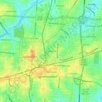
Name: Cumberland topographic map, elevation, terrain.

Location: Cumberland, Greensboro, Guilford County, North Carolina, 27401, United States (36.05486 -79.80170 36.09486 -79.76170)

Average elevation: 244 m

Minimum elevation: 224 m

Maximum elevation: 267 m

Other topographic maps

Click on a map to view its topography, its elevation and its terrain.
Gear up for your next adventure:

🛏️Camping Sleeping Mat - Comfortable mats for sleeping outdoors
🛶Canoe Life Vest - Safety vest for water sports
🥽Outdoor Goggles - Protective eyewear for outdoor activities
🐕Hiking Dog Pack - Let your canine companion carry their own water and food
🧴Waterproofing Spray - Restore the DWR coating on jackets and tents

As an Amazon Associate, this site earns from qualifying purchases at no extra cost to you.