Geolocate

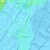
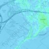
Kaag topographic map

Click on the map to display elevation.

About this map

Name: Kaag topographic map, elevation, terrain.

Location: Kaag, Kaag en Braassem, South Holland, Netherlands (52.20636 4.55428 52.21889 4.59849)

Average elevation: -2 m

Minimum elevation: -6 m

Maximum elevation: 7 m

Other topographic maps

Click on a map to view its topography, its elevation and its terrain.

Tweede Tol

Netherlands > South Holland > Dordrecht

Average elevation: 0 m

Gooland

Netherlands > South Holland > Nootdorp

Average elevation: -2 m

Langeraar

Netherlands > South Holland

Average elevation: -3 m

Meije

Netherlands > South Holland > Nieuwkoop

Average elevation: -2 m

Meijendel

Netherlands > South Holland > Wassenaar

Average elevation: 6 m

Weerestein

Netherlands > South Holland > Hillegom

Average elevation: 0 m

Botlek

Netherlands > South Holland

Average elevation: 3 m

Weerestein

Netherlands > South Holland > Hillegom

Average elevation: 0 m

Ankerpark

Netherlands > South Holland > Leiden

Average elevation: 3 m

Waalhaven

Netherlands > South Holland > Rotterdam

Average elevation: 3 m

Middelsluis

Netherlands > South Holland > Numansdorp

Average elevation: 0 m

Coepelduynen

Netherlands > South Holland > Katwijk

Average elevation: 4 m

Broekhuizen

Netherlands > South Holland > Gouda

Average elevation: -1 m

Het Park

Netherlands > South Holland > Rotterdam

Average elevation: 4 m

Gear up for your next adventure:

📷Outdoor Action Camera - Capture high-elevation views and rugged adventures
🧭GPS Tracker - Track your location in remote areas safely
🔥Camping Stove - Portable stoves to cook outdoors with ease
🎒Hiking Backpack - Lightweight and ergonomic backpacks for day hikes or multi-day treks
🧼Travel Hand Sanitizer - Keep hands clean when water is scarce

As an Amazon Associate, this site earns from qualifying purchases at no extra cost to you.