Geolocate

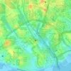
Larkin Jaya topographic map

Click on the map to display elevation.

About this map

Name: Larkin Jaya topographic map, elevation, terrain.

Location: Larkin Jaya, Johor Bahru, Johor, 80350, Malaysia (1.47889 103.71915 1.51889 103.75915)

Average elevation: 31 m

Minimum elevation: 0 m

Maximum elevation: 60 m

Other topographic maps

Click on a map to view its topography, its elevation and its terrain.

Sungai Sekudai

Malaysia > Johor > Johor Bahru > Skudai

Average elevation: 23 m

Kampung Setanggi

Malaysia > Johor > Johor Bahru

Average elevation: 15 m

Sungai Stulang

Malaysia > Johor > Johor Bahru

Average elevation: 11 m

Sungai Segget

Malaysia > Johor > Johor Bahru

Average elevation: 24 m

Sungai Lunchu

Malaysia > Johor > Johor Bahru

Average elevation: 15 m

Sungai Segget

Malaysia > Johor > Johor Bahru

Average elevation: 20 m

Sungai Segget

Malaysia > Johor > Johor Bahru

Average elevation: 22 m

Tebrau River

Malaysia > Johor > Johor Bahru

Average elevation: 5 m

Gear up for your next adventure:

🥾Hiking Leggings - Comfortable leggings for outdoor activities
🥾Approach Boots - Comfortable boots for hiking and climbing approaches
🧦Crew Hiking Socks - Comfortable socks for long-distance hikes
🥾Waterproof Hiking Boots - Essential footwear for rugged terrain and wet Canadian trails
⛺Tent Footprint - Protect tent floor and increase durability

As an Amazon Associate, this site earns from qualifying purchases at no extra cost to you.