Geolocate

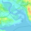
Sungai Segget topographic map

Click on the map to display elevation.

About this map

Name: Sungai Segget topographic map, elevation, terrain.

Location: Sungai Segget, Kampung Wadi Hana, Johor Bahru, Johor, 80730, Malaysia (1.46738 103.75915 1.46825 103.75956)

Average elevation: 24 m

Minimum elevation: -2 m

Maximum elevation: 60 m

Other topographic maps

Click on a map to view its topography, its elevation and its terrain.

Larkin Jaya

Malaysia > Johor > Johor Bahru

Average elevation: 31 m

Kampung Bakar Batu

Malaysia > Johor > Johor Bahru

Average elevation: 8 m

Kampung Kebun Teh

Malaysia > Johor > Johor Bahru

Average elevation: 29 m

Kampung Bakar Batu

Malaysia > Johor > Johor Bahru

Average elevation: 8 m

Kampung Kebun Teh

Malaysia > Johor > Johor Bahru

Average elevation: 29 m

Straits of Johor

Malaysia > Johor > Johor Bahru

Average elevation: 3 m

Kampung Aman

Malaysia > Johor > Johor Bahru

Average elevation: 31 m

Kampung Ah Siang

Malaysia > Johor > Johor Bahru

Average elevation: 15 m

Kampung Bendahara

Malaysia > Johor > Johor Bahru

Average elevation: 17 m

Gear up for your next adventure:

🥾Trail Hiking Boots - Supportive boots for rough trails
🦯Trekking Poles - Reduced impact on joints for steep topographic climbs
🧢Outdoor Visor - Breathable visor for sunny hikes
🥾Trail Hiking Socks - Comfortable socks to prevent blisters and fatigue
☕Camping Coffee Maker - Brew fresh coffee anywhere on the topographic map

As an Amazon Associate, this site earns from qualifying purchases at no extra cost to you.