Geolocate

Charing topographic map

Click on the map to display elevation.

About this map
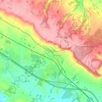
Name: Charing topographic map, elevation, terrain.

Location: Charing, Ashford, Kent, England, United Kingdom (51.18929 0.74004 51.23937 0.84950)

Average elevation: 122 m

Minimum elevation: 46 m

Maximum elevation: 198 m

Gear up for your next adventure:

🛌Down Sleeping Bag - Superior warmth-to-weight ratio for cold nights
🗺️Topographic Maps - Detailed maps to explore trails, mountains, and wilderness areas
📷Outdoor Action Camera - Capture high-elevation views and rugged adventures
🥘Camping Cookware Set - Compact nesting pots and pans for trail cooking
💧Hydration Bladder - Hands-free hydration solution for long treks

As an Amazon Associate, this site earns from qualifying purchases at no extra cost to you.