Geolocate

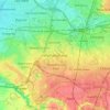
Philips Park topographic map

Click on the map to display elevation.

About this map

Name: Philips Park topographic map, elevation, terrain.

Location: Philips Park, Bradford, Manchester, Greater Manchester, England, United Kingdom (53.48624 -2.19951 53.48999 -2.19000)

Average elevation: 67 m

Minimum elevation: 40 m

Maximum elevation: 92 m

Other topographic maps

Click on a map to view its topography, its elevation and its terrain.

Piccadilly

United Kingdom > England > Manchester

Average elevation: 46 m

Wythenshawe

United Kingdom > England > Manchester

Average elevation: 54 m

Cheetham

United Kingdom > England > Manchester

Average elevation: 54 m

Sharston

United Kingdom > England > Manchester > Wythenshawe

Average elevation: 55 m

Hulme Park

United Kingdom > England > Manchester

Average elevation: 37 m

Chorlton

United Kingdom > England > Manchester

Average elevation: 29 m

Wythenshawe

United Kingdom > England > Manchester

Average elevation: 54 m

Wythenshawe

United Kingdom > England > Manchester

Average elevation: 54 m

Platt Fields Park

United Kingdom > England > Manchester

Average elevation: 41 m

Gear up for your next adventure:

🚲Heavy Duty Bike Lock - Secure your bike at the trailhead or during stops
💡Compact LED Flashlight - Powerful and portable flashlight for outdoor use
🔋Solar Power Bank - Keep your GPS and devices charged during long outdoor trips
🥾All-Terrain Hiking Boots - Versatile boots for varied hiking conditions
🛌Down Sleeping Bag - Superior warmth-to-weight ratio for cold nights

As an Amazon Associate, this site earns from qualifying purchases at no extra cost to you.