Geolocate

Cold Norton topographic map

Click on the map to display elevation.

About this map

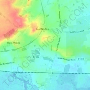
Name: Cold Norton topographic map, elevation, terrain.

Location: Cold Norton, Maldon, Essex, England, United Kingdom (51.64914 0.61796 51.67724 0.69337)

Average elevation: 19 m

Minimum elevation: -3 m

Maximum elevation: 72 m

Gear up for your next adventure:

🧊Portable Cooler - Keep food and drinks cold during outdoor adventures
🐕Hiking Dog Pack - Let your canine companion carry their own water and food
🛁Quick-Dry Microfiber Towel - Space-saving towel that dries rapidly on the move
🧶550 Survival Paracord - Versatile utility cord for emergency repairs and rigging
🔦LED Headlamp - Hands-free lighting for early morning starts or late finishes

As an Amazon Associate, this site earns from qualifying purchases at no extra cost to you.