Geolocate

Bergh Apton topographic map

Click on the map to display elevation.

About this map

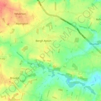
Name: Bergh Apton topographic map, elevation, terrain.

Location: Bergh Apton, South Norfolk, Norfolk, England, United Kingdom (52.53940 1.37869 52.56960 1.45042)

Average elevation: 28 m

Minimum elevation: 6 m

Maximum elevation: 52 m

Gear up for your next adventure:

🌡️Emergency Mylar Blankets - Compact thermal protection for unexpected nights outdoors
🧼Biodegradable Camp Soap - Environmentally friendly cleaning for gear and body
🧢Beanie Hat - Keep your head warm in cold weather
🔥Emergency Fire Starter - Reliable ignition source for all weather conditions
🛏️Sleeping Bag - Warm and compact sleeping bags for outdoor camping

As an Amazon Associate, this site earns from qualifying purchases at no extra cost to you.