Geolocate

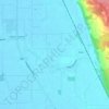
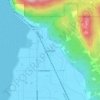
Urban topographic map

Click on the map to display elevation.

About this map

Name: Urban topographic map, elevation, terrain.

Location: Urban, Skagit County, Washington, United States (48.59788 -122.71212 48.63788 -122.67212)

Average elevation: 11 m

Minimum elevation: -1 m

Maximum elevation: 199 m

Other topographic maps

Click on a map to view its topography, its elevation and its terrain.

Anacortes

United States > Washington > Skagit County

Average elevation: 36 m

Mount Vernon

United States > Washington > Skagit County

Average elevation: 37 m

Hamilton

United States > Washington > Skagit County

Average elevation: 53 m

Bow

United States > Washington > Skagit County

Average elevation: 9 m

La Conner

United States > Washington > Skagit County

Average elevation: 14 m

Lake Erie

United States > Washington > Skagit County > Anacortes

Average elevation: 109 m

Burlington

United States > Washington > Skagit County

Average elevation: 12 m

Concrete

United States > Washington > Skagit County

Mears Field (3W5), formerly known as Concrete Municipal Airport, is located one mile south of Concrete at an elevation of 267 ft MSL.

Average elevation: 125 m

Alger

United States > Washington > Skagit County

Average elevation: 130 m

Blanchard

United States > Washington > Skagit County

Average elevation: 49 m

Anacortes

United States > Washington > Skagit County

Average elevation: 36 m

Mount Vernon

United States > Washington > Skagit County

Average elevation: 37 m

Bay View

United States > Washington > Skagit County

Average elevation: 19 m

Mount Vernon

United States > Washington > Skagit County

Average elevation: 37 m

Burlington

United States > Washington > Skagit County

Average elevation: 12 m

Burlington

United States > Washington > Skagit County

Average elevation: 12 m

Bow

United States > Washington > Skagit County

Average elevation: 9 m

Dome Glacier

United States > Washington > Skagit County

Average elevation: 2,146 m

Marblemount

United States > Washington > Skagit County

Average elevation: 249 m

Bay View

United States > Washington > Skagit County

Average elevation: 19 m

Gear up for your next adventure:

🦶Hiking Shoe Insoles - Added support for high arches and long days on feet
🔭Compact Monocular - One-handed bird watching and trail spotting
🧢Sun Protection Cap - Breathable cap to protect from sun exposure
🧊Insulated Water Bottle - Keeps drinks cold in summer and prevents freezing in winter
🧢Hiking Sun Hat - Wide-brimmed protection for exposed mountain ridges

As an Amazon Associate, this site earns from qualifying purchases at no extra cost to you.