Geolocate

Forcat topographic map

Click on the map to display elevation.

About this map

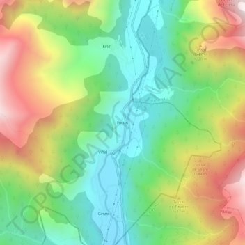
Name: Forcat topographic map, elevation, terrain.

Location: Forcat, Montanuy, La Ribagorza, Huesca, Aragon, 25552, Spain (42.48966 0.69786 42.52966 0.73786)

Average elevation: 1,398 m

Minimum elevation: 975 m

Maximum elevation: 2,055 m

Gear up for your next adventure:

🧭GPS Outdoor Watch - Smart watch for navigation and fitness tracking in nature
🦶Hiking Shoe Insoles - Added support for high arches and long days on feet
🥘Camping Cookware Set - Compact nesting pots and pans for trail cooking
💧Hydration Bladder - Hands-free hydration solution for long treks
🧰Survival Kit - Essential gear for emergencies in the wilderness

As an Amazon Associate, this site earns from qualifying purchases at no extra cost to you.