Geolocate

Finney topographic map

Click on the map to display elevation.

About this map
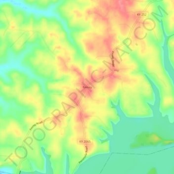
Name: Finney topographic map, elevation, terrain.

Location: Finney, Barren County, Kentucky, United States (36.89532 -86.12498 36.93532 -86.08498)

Average elevation: 187 m

Minimum elevation: 147 m

Maximum elevation: 230 m

Gear up for your next adventure:

🧦Crew Hiking Socks - Comfortable socks for long-distance hikes
🧢Hiking Sun Hat - Wide-brimmed protection for exposed mountain ridges
🧭Orienteering Kit - Tools for map reading and navigation in the wild
🧳Compression Sacks - Maximize space in your backpack by shrinking gear
🧦Outdoor Socks - Durable socks designed for hiking and outdoor sports

As an Amazon Associate, this site earns from qualifying purchases at no extra cost to you.