
Village of Whitehall topographic map
Interactive map
Click on the map to display elevation.
About this map
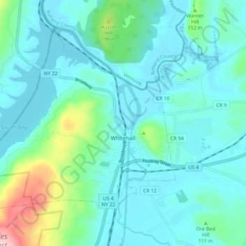
Name: Village of Whitehall topographic map, elevation, terrain.
Average elevation: 84 m
Minimum elevation: 22 m
Maximum elevation: 400 m
Other topographic maps
Click on a map to view its topography, its elevation and its terrain.
Black Mountain
United States > New York > Washington County
Black Mountain, Washington County, New York, 12841, United States
Average elevation: 487 m
Town of Argyle
United States > New York > Washington County
Town of Argyle, Washington County, New York, United States
Average elevation: 130 m
Town of Hebron
United States > New York > Washington County
Town of Hebron, Washington County, New York, United States
Average elevation: 241 m