Geolocate

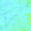
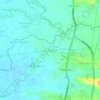
Tambubong topographic map

Click on the map to display elevation.

About this map

Name: Tambubong topographic map, elevation, terrain.

Location: Tambubong, San Rafael, Bulacan, Central Luzon, 3008, Philippines (14.96145 120.91494 14.97797 120.93373)

Average elevation: 18 m

Minimum elevation: 7 m

Maximum elevation: 28 m

Other topographic maps

Click on a map to view its topography, its elevation and its terrain.

Diliman I

Philippines > Bulacan > San Rafael

Average elevation: 25 m

Purok 3

Philippines > Bulacan > San Rafael

Average elevation: 19 m

Tukod

Philippines > Bulacan > San Rafael

Average elevation: 79 m

Mabalas-balas

Philippines > Bulacan > San Rafael

Average elevation: 23 m

Lico

Philippines > Bulacan > San Rafael > Lico

Average elevation: 26 m

Dagat-dagatan

Philippines > Bulacan > San Rafael > Dagat-dagatan

Average elevation: 14 m

Pulong Bayabas

Philippines > Bulacan > San Rafael

Average elevation: 12 m

Maronquillo

Philippines > Bulacan > San Rafael

Average elevation: 39 m

Sapang Pahalang

Philippines > Bulacan > San Rafael

Average elevation: 72 m

Coral na Bato

Philippines > Bulacan > San Rafael

Average elevation: 42 m

San Agustin

Philippines > Bulacan > San Rafael

Average elevation: 17 m

Cruz na Daan

Philippines > Bulacan > San Rafael > Cruz na Daan

Average elevation: 19 m

Dagat-dagatan

Philippines > Bulacan > San Rafael

Average elevation: 14 m

Tukod

Philippines > Bulacan > San Rafael

Average elevation: 79 m

Gear up for your next adventure:

🧳Compression Sacks - Maximize space in your backpack by shrinking gear
🧦Merino Wool Socks - Moisture-wicking comfort for long-distance hiking
🎒Hiking Backpack - Lightweight and ergonomic backpacks for day hikes or multi-day treks
🥾Waterproof Trail Shoes - Shoes designed to handle wet terrain
🛶Kayak Accessories - Essential gear for safe and fun kayaking adventures

As an Amazon Associate, this site earns from qualifying purchases at no extra cost to you.