Geolocate

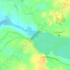
Lico topographic map

Click on the map to display elevation.

About this map

Name: Lico topographic map, elevation, terrain.

Location: Lico, San Rafael, Bulacan, Central Luzon, 3007, Philippines (14.93870 120.93775 14.97870 120.97775)

Average elevation: 26 m

Minimum elevation: 8 m

Maximum elevation: 50 m

Other topographic maps

Click on a map to view its topography, its elevation and its terrain.
Bustos Dam

Philippines > Bulacan > San Rafael > Lico

Average elevation: 24 m

Gear up for your next adventure:

🚑Survival Whistle - Signal for help across long distances in mountains
🥾Mountain Hiking Shoes - Shoes with superior grip for mountainous terrain
🏃Hydration Running Vest - Carry water and maps close to your body for speed
🚲MTB Frame Bag - Carry tools and maps directly on your bicycle frame
🍽️Titanium Camping Spork - Ultralight and indestructible eating utensil

As an Amazon Associate, this site earns from qualifying purchases at no extra cost to you.