Geolocate

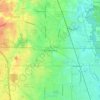
Chicago Heights topographic map

Click on the map to display elevation.

About this map

Name: Chicago Heights topographic map, elevation, terrain.

Location: Chicago Heights, Bloom Township, Cook County, Illinois, 60411, United States (41.48141 -87.67443 41.54336 -87.59686)

Average elevation: 203 m

Minimum elevation: 184 m

Maximum elevation: 228 m

Other topographic maps

Click on a map to view its topography, its elevation and its terrain.

Dunbar Park

United States > Illinois > Cook County > Chicago

Average elevation: 182 m

Buffalo Grove

United States > Illinois > Cook County

Average elevation: 210 m

Gear up for your next adventure:

🥾Trekking Poles - Adjustable trekking poles to reduce knee stress and improve stability
🛶Kayak Dry Bag - Waterproof storage for kayaking adventures
🧦Hiking Socks - Moisture-wicking and comfortable socks for long hikes
🌡️Emergency Mylar Blankets - Compact thermal protection for unexpected nights outdoors
🥤Collapsible Travel Cup - Saves space and weight in your mess kit

As an Amazon Associate, this site earns from qualifying purchases at no extra cost to you.