Geolocate

Padesh topographic map

Click on the map to display elevation.

About this map

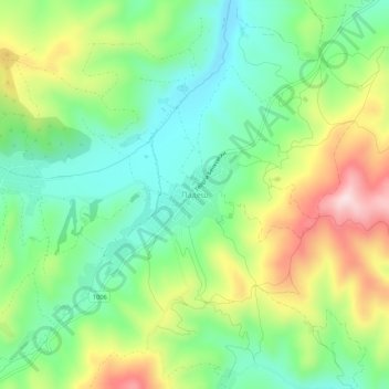
Name: Padesh topographic map, elevation, terrain.

Location: Padesh, Blagoevgrad, 2747, Bulgaria (41.91149 22.98252 41.95149 23.02252)

Average elevation: 634 m

Minimum elevation: 502 m

Maximum elevation: 860 m

Gear up for your next adventure:

🔦LED Headtorch - Bright and durable light for night activities
💡LED Camping Lantern - Illuminate your campsite with long-lasting lanterns
🗺️Topographic Maps - Detailed maps to explore trails, mountains, and wilderness areas
🧭Orienteering Kit - Tools for map reading and navigation in the wild
Lightweight Camping Tent - Portable shelter optimized for Canadian backcountry camping

As an Amazon Associate, this site earns from qualifying purchases at no extra cost to you.