
Waterford topographic map
Click on the map to display elevation.
About this map
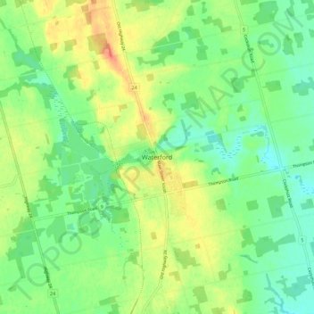
Name: Waterford topographic map, elevation, terrain.
Location: Waterford, Norfolk County, Ontario, N0E 1Y0, Canada (42.89451 -80.33077 42.97451 -80.25077)
Average elevation: 237 m
Minimum elevation: 218 m
Maximum elevation: 265 m
Norfolk County trails, hiking, mountain biking, running and outdoor activities
Other topographic maps
Click on a map to view its topography, its elevation and its terrain.
Turkey Point Provincial Park
Canada > Ontario > Norfolk County > Turkey Point
Average elevation: 192 m