
River Hills topographic map
Click on the map to display elevation.
About this map
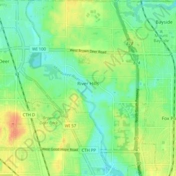
Name: River Hills topographic map, elevation, terrain.
Location: River Hills, Milwaukee County, Wisconsin, United States (43.14048 -87.96230 43.19243 -87.91516)
Average elevation: 209 m
Minimum elevation: 194 m
Maximum elevation: 230 m
Other topographic maps
Click on a map to view its topography, its elevation and its terrain.
Lakeshore State Park
United States > Wisconsin > Milwaukee County > Milwaukee
Average elevation: 180 m