Geolocate

Milwaukee topographic map

Click on the map to display elevation.

About this map

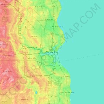
Name: Milwaukee topographic map, elevation, terrain.

Location: Milwaukee, Milwaukee County, Wisconsin, 53233-2620, United States (42.87499 -88.08250 43.19499 -87.76250)

Average elevation: 207 m

Minimum elevation: 169 m

Maximum elevation: 294 m

Other topographic maps

Click on a map to view its topography, its elevation and its terrain.

Gear up for your next adventure:

🚑Survival Whistle - Signal for help across long distances in mountains
🥾Approach Shoes - Shoes designed for climbing approaches and rugged trails
🗺️Topographic Maps - Detailed maps to explore trails, mountains, and wilderness areas
🧢Sun Protection Cap - Breathable cap to protect from sun exposure
🔭Outdoor Binoculars - Lightweight binoculars for birdwatching and hiking

As an Amazon Associate, this site earns from qualifying purchases at no extra cost to you.