Geolocate

Calgar topographic map

Click on the map to display elevation.

About this map

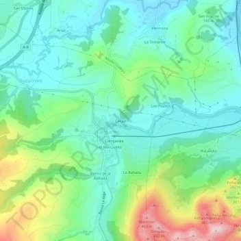
Name: Calgar topographic map, elevation, terrain.

Location: Calgar, Liérganes, Trasmiera, Cantabria, 39722, Spain (43.32752 -3.76033 43.36752 -3.72033)

Average elevation: 150 m

Minimum elevation: 38 m

Maximum elevation: 440 m

Gear up for your next adventure:

🕶️Polarized Sunglasses - Reduces glare from snow and water at high elevations
🧰Multitool Knife - Compact and versatile tool for outdoor use
👖Convertible Hiking Pants - Zip-off legs to adapt to changing weather conditions
🧭GPS Outdoor Watch - Smart watch for navigation and fitness tracking in nature
💧Filtered Water Bottle - Safe drinking water on the go

As an Amazon Associate, this site earns from qualifying purchases at no extra cost to you.