Geolocate

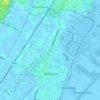
Valkenburg topographic map

Click on the map to display elevation.

About this map

Name: Valkenburg topographic map, elevation, terrain.

Location: Valkenburg, Katwijk, South Holland, Netherlands (52.15565 4.40411 52.18437 4.44885)

Average elevation: 0 m

Minimum elevation: -5 m

Maximum elevation: 13 m

Other topographic maps

Click on a map to view its topography, its elevation and its terrain.

Tweede Tol

Netherlands > South Holland > Dordrecht

Average elevation: 0 m

Gooland

Netherlands > South Holland > Nootdorp

Average elevation: -2 m

Langeraar

Netherlands > South Holland

Average elevation: -3 m

Waalhaven

Netherlands > South Holland > Rotterdam

Average elevation: 3 m

Meijendel

Netherlands > South Holland > Wassenaar

Average elevation: 6 m

Meije

Netherlands > South Holland > Nieuwkoop

Average elevation: -2 m

Weerestein

Netherlands > South Holland > Hillegom

Average elevation: 0 m

Botlek

Netherlands > South Holland

Average elevation: 3 m

Ankerpark

Netherlands > South Holland > Leiden

Average elevation: 3 m

Weerestein

Netherlands > South Holland > Hillegom

Average elevation: 0 m

Middelsluis

Netherlands > South Holland > Numansdorp

Average elevation: 0 m

Coepelduynen

Netherlands > South Holland > Katwijk

Average elevation: 4 m

Broekhuizen

Netherlands > South Holland > Gouda

Average elevation: -1 m

Het Park

Netherlands > South Holland > Rotterdam

Average elevation: 4 m

Gear up for your next adventure:

🥤Collapsible Travel Cup - Saves space and weight in your mess kit
🔦UV Flashlight - Detect minerals or specific insects in the dark
👟Sport Hiking Sandals - Breathable footwear for water crossings and camp rest
🧢Beanie Hat - Keep your head warm in cold weather
💡Compact LED Flashlight - Powerful and portable flashlight for outdoor use

As an Amazon Associate, this site earns from qualifying purchases at no extra cost to you.