Geolocate

Loring topographic map

Click on the map to display elevation.

About this map

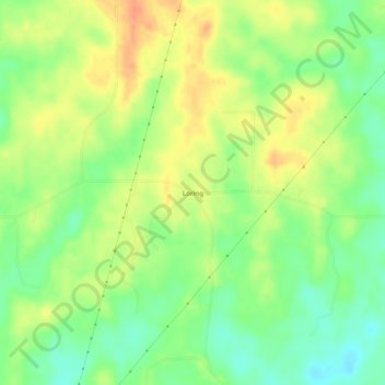
Name: Loring topographic map, elevation, terrain.

Location: Loring, Madison County, Mississippi, United States (32.76041 -89.95786 32.80041 -89.91786)

Average elevation: 83 m

Minimum elevation: 61 m

Maximum elevation: 104 m

Other topographic maps

Click on a map to view its topography, its elevation and its terrain.

Canton

United States > Mississippi > Madison County

Average elevation: 75 m

Gear up for your next adventure:

🥾Light Trekking Boots - Supportive boots for multi-day treks
🥾Durable Hiking Shoes - Long-lasting shoes for frequent hiking
🧢Sun Hat - Wide-brim hat for sun protection
🥾Waterproof Hiking Shoes - Durable shoes for wet and rugged trails
🛶Waterproof Dry Bags - Keep electronics and clothes dry during river crossings

As an Amazon Associate, this site earns from qualifying purchases at no extra cost to you.