
Alrewas topographic map
Interactive map
Click on the map to display elevation.
About this map
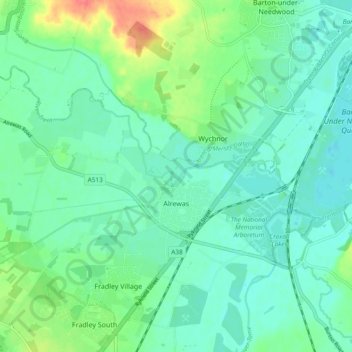
Name: Alrewas topographic map, elevation, terrain.
Location: Alrewas, Lichfield, Staffordshire, Angleterre, Royaume-Uni (52.72261 -1.81107 52.75097 -1.71694)
Average elevation: 59 m
Minimum elevation: 44 m
Maximum elevation: 100 m
Other topographic maps
Click on a map to view its topography, its elevation and its terrain.
Lichfield
Royaume-Uni > Angleterre > Staffordshire > Lichfield
Lichfield, Staffordshire, Angleterre, Royaume-Uni
Average elevation: 91 m