
Tonj South topographic map
Interactive map
Click on the map to display elevation.
About this map
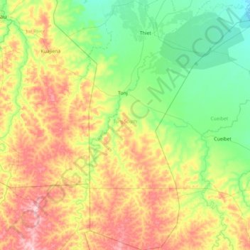
Name: Tonj South topographic map, elevation, terrain.
Location: Tonj South, Warrap, South Sudan (6.38812 28.37242 7.79002 29.15366)
Average elevation: 464 m
Minimum elevation: 403 m
Maximum elevation: 610 m
Other topographic maps
Click on a map to view its topography, its elevation and its terrain.