Geolocate

Lodgepole topographic map

Click on the map to display elevation.

About this map

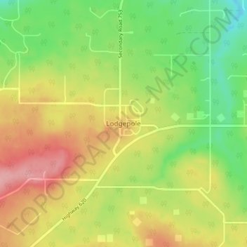
Name: Lodgepole topographic map, elevation, terrain.

Location: Lodgepole, Brazeau County, Alberta, Canada (53.07957 -115.33706 53.11957 -115.29706)

Average elevation: 915 m

Minimum elevation: 860 m

Maximum elevation: 977 m

Brazeau County trails, hiking, mountain biking, running and outdoor activities

Gear up for your next adventure:

🥾Approach Shoes - Shoes designed for climbing approaches and rugged trails
🧊Portable Cooler - Keep food and drinks cold during outdoor adventures
🥾Hiking Shorts - Breathable shorts suitable for summer hikes
🔋Solar Power Bank - Keep your GPS and devices charged during long outdoor trips
Lightweight Backpacking Tent - Compact tent for efficient hiking trips

As an Amazon Associate, this site earns from qualifying purchases at no extra cost to you.