
Shabbington topographic map
Click on the map to display elevation.
About this map
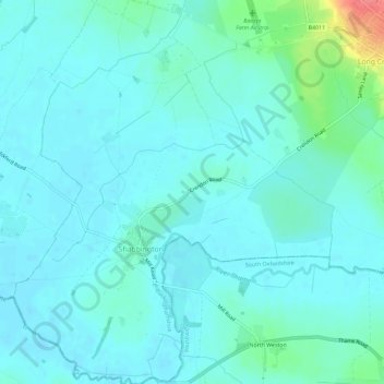
Name: Shabbington topographic map, elevation, terrain.
Location: Shabbington, Buckinghamshire, England, United Kingdom (51.74406 -1.05499 51.77981 -1.00679)
Average elevation: 67 m
Minimum elevation: 56 m
Maximum elevation: 124 m
Other topographic maps
Click on a map to view its topography, its elevation and its terrain.
Hotley Bottom
United Kingdom > England > Buckinghamshire > Great Missenden > Prestwood
Average elevation: 182 m
Wapsey's Wood Landfill Site
United Kingdom > England > Buckinghamshire > Beaconsfield > Jordans
Average elevation: 93 m
Doddershall Wood
United Kingdom > England > Buckinghamshire > Grendon Underwood
Average elevation: 77 m