Geolocate

Cedar Bluff topographic map

Click on the map to display elevation.

About this map

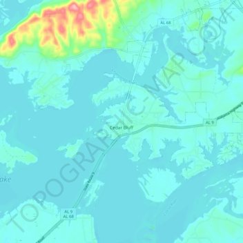
Name: Cedar Bluff topographic map, elevation, terrain.

Location: Cedar Bluff, Cherokee County, Alabama, 35959, United States (34.18860 -85.64283 34.25579 -85.54034)

Average elevation: 180 m

Minimum elevation: 163 m

Maximum elevation: 310 m

Other topographic maps

Click on a map to view its topography, its elevation and its terrain.

Taft

United States > Alabama > Cherokee County

Average elevation: 275 m

Gear up for your next adventure:

🧥Fleece Jacket - Warm and lightweight jacket for layering
🥘Camping Cookware Set - Compact nesting pots and pans for trail cooking
🧥Softshell Jacket - Windproof and breathable jacket for hiking
🧦Hiking Socks - Moisture-wicking and comfortable socks for long hikes
🧴Waterproofing Spray - Restore the DWR coating on jackets and tents

As an Amazon Associate, this site earns from qualifying purchases at no extra cost to you.