Geolocate

Marlstein topographic map

Click on the map to display elevation.

About this map

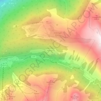
Name: Marlstein topographic map, elevation, terrain.

Location: Marlstein, Haiming, Bezirk Imst, Tyrol, 6424, Austria (47.21227 10.94032 47.25227 10.98032)

Average elevation: 1,932 m

Minimum elevation: 1,146 m

Maximum elevation: 2,574 m

Gear up for your next adventure:

🔥Camping Stove - Portable stoves to cook outdoors with ease
🦶Anti-Blister Balm - Prevents friction and hotspots during long ascents
🥾Mountain Hiking Shoes - Shoes with superior grip for mountainous terrain
Bushcraft Tarp - Versatile emergency shelter or gear protection
🔦LED Headlamp - Hands-free lighting for early morning starts or late finishes

As an Amazon Associate, this site earns from qualifying purchases at no extra cost to you.