Geolocate

El Trebal topographic map

Click on the map to display elevation.

About this map

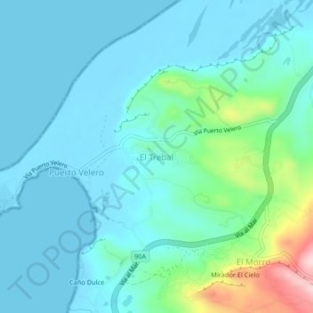
Name: El Trebal topographic map, elevation, terrain.

Location: El Trebal, Tubará, Atlántico, Colombia (10.93348 -75.03822 10.97348 -74.99822)

Average elevation: 45 m

Minimum elevation: -1 m

Maximum elevation: 260 m

Other topographic maps

Click on a map to view its topography, its elevation and its terrain.

Juaruco

Colombia > Atlántico > Tubará

Average elevation: 176 m

Gear up for your next adventure:

🥾Approach Shoes - Shoes designed for climbing approaches and rugged trails
🔦LED Headtorch - Bright and durable light for night activities
🧢Hiking Hat - Sun-protective and breathable hats for long treks
🧭GPS Outdoor Watch - Smart watch for navigation and fitness tracking in nature
🕶️Polarized Sunglasses - Protect your eyes with durable polarized lenses

As an Amazon Associate, this site earns from qualifying purchases at no extra cost to you.