Geolocate

Rish topographic map

Click on the map to display elevation.

About this map

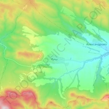
Name: Rish topographic map, elevation, terrain.

Location: Rish, Smiadovo, Shumen, Bulgaria (42.93488 26.86099 43.02843 26.98762)

Average elevation: 374 m

Minimum elevation: 178 m

Maximum elevation: 799 m

Gear up for your next adventure:

🧤Insulated Winter Gloves - Heavy-duty protection for sub-zero Canadian adventures
📷Outdoor Action Camera - Capture high-elevation views and rugged adventures
🧰Survival Kit - Essential gear for emergencies in the wilderness
🎒Fully Waterproof Backpack - Total protection for photography gear and electronics
🧥Fleece Jacket - Warm and lightweight jacket for layering

As an Amazon Associate, this site earns from qualifying purchases at no extra cost to you.