Geolocate

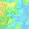
Reydon topographic map

Click on the map to display elevation.

About this map

Name: Reydon topographic map, elevation, terrain.

Location: Reydon, East Suffolk, Suffolk, England, United Kingdom (52.32396 1.62564 52.36451 1.69739)

Average elevation: 6 m

Minimum elevation: -6 m

Maximum elevation: 21 m

Other topographic maps

Click on a map to view its topography, its elevation and its terrain.
Henstead

United Kingdom > England > Suffolk > East Suffolk

Average elevation: 13 m

Somerleyton

United Kingdom > England > Suffolk > East Suffolk

Average elevation: 9 m

Wenhaston

United Kingdom > England > Suffolk > East Suffolk

Average elevation: 16 m

Hulver Street

United Kingdom > England > Suffolk > East Suffolk

Average elevation: 16 m

Sibton Green

United Kingdom > England > Suffolk > East Suffolk

Average elevation: 35 m

Sweffling

United Kingdom > England > Suffolk > East Suffolk

Average elevation: 32 m

Thorpeness

United Kingdom > England > Suffolk > East Suffolk

Average elevation: 4 m

Eastbridge

United Kingdom > England > Suffolk > East Suffolk

Average elevation: 10 m

Benhall Green

United Kingdom > England > Suffolk > East Suffolk

Average elevation: 21 m

Butley Abbey

United Kingdom > England > Suffolk > East Suffolk > Butley

Average elevation: 9 m

Hinton

United Kingdom > England > Suffolk > East Suffolk > Blythburgh

Average elevation: 19 m

Kelsale

United Kingdom > England > Suffolk > East Suffolk

Average elevation: 32 m

Wangford

United Kingdom > England > Suffolk > East Suffolk

Average elevation: 13 m

Thorpeness

United Kingdom > England > Suffolk > East Suffolk

Average elevation: 4 m

Wangford

United Kingdom > England > Suffolk > East Suffolk

Average elevation: 13 m

Sizewell

United Kingdom > England > Suffolk > East Suffolk > Leiston

Average elevation: 5 m

Sweffling

United Kingdom > England > Suffolk > East Suffolk

Average elevation: 32 m

Wangford

United Kingdom > England > Suffolk > East Suffolk

Average elevation: 13 m

Sizewell

United Kingdom > England > Suffolk > East Suffolk > Leiston

Average elevation: 5 m

Gear up for your next adventure:

🧰Emergency Multi-Tool - Compact multi-tool for outdoor survival
🛁Quick-Dry Microfiber Towel - Space-saving towel that dries rapidly on the move
🧴Waterproofing Spray - Restore the DWR coating on jackets and tents
🚲MTB Frame Bag - Carry tools and maps directly on your bicycle frame
🛏️Sleeping Bag - Warm and compact sleeping bags for outdoor camping

As an Amazon Associate, this site earns from qualifying purchases at no extra cost to you.