Geolocate

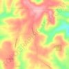
Higden topographic map

Click on the map to display elevation.

About this map
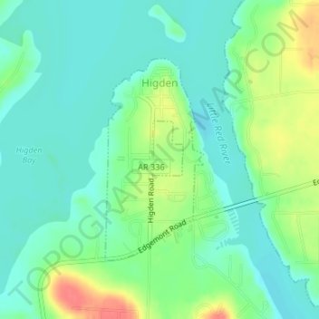
Name: Higden topographic map, elevation, terrain.

Location: Higden, Cleburne County, Arkansas, United States (35.55833 -92.20889 35.57546 -92.19859)

Average elevation: 152 m

Minimum elevation: 134 m

Maximum elevation: 192 m

Other topographic maps

Click on a map to view its topography, its elevation and its terrain.
Tannenbaum

United States > Arkansas > Cleburne County

Average elevation: 179 m

Prim

United States > Arkansas > Cleburne County

Average elevation: 353 m

Ida

United States > Arkansas > Cleburne County

Average elevation: 282 m

Hopewell

United States > Arkansas > Cleburne County

Average elevation: 254 m

Edgemont

United States > Arkansas > Cleburne County

Average elevation: 178 m

Concord

United States > Arkansas > Cleburne County > Concord > Concord

Average elevation: 298 m

Eden Isle

United States > Arkansas > Cleburne County

Average elevation: 215 m

West Pangburn

United States > Arkansas > Cleburne County

Average elevation: 142 m

Gear up for your next adventure:

💡Compact LED Flashlight - Powerful and portable flashlight for outdoor use
🔦LED Headtorch - Bright and durable light for night activities
🥽Outdoor Goggles - Protective eyewear for outdoor activities
🥾Trail Running Shoes - Lightweight and durable shoes for trail running
🎒Hiking Daypack - Lightweight and durable backpacks for day trips and excursions

As an Amazon Associate, this site earns from qualifying purchases at no extra cost to you.