Geolocate

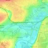
Saint-Jean topographic map

Click on the map to display elevation.

About this map
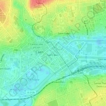
Name: Saint-Jean topographic map, elevation, terrain.

Location: Saint-Jean, Caen, Calvados, Normandie, France métropolitaine, 14000, France (49.17742 -0.36086 49.18468 -0.34931)

Average elevation: 20 m

Minimum elevation: -2 m

Maximum elevation: 56 m

Other topographic maps

Click on a map to view its topography, its elevation and its terrain.
Bas de Venoix

France > Normandie > Calvados > Caen

Average elevation: 23 m

Manoir des Gens d'Armes

France > Normandie > Calvados > Caen

Average elevation: 21 m

Vallée des Jardins

France > Normandie > Calvados > Caen

Average elevation: 48 m

Gear up for your next adventure:

🧰Survival Kit - Essential gear for emergencies in the wilderness
🥾All-Terrain Hiking Boots - Versatile boots for varied hiking conditions
🧭GPS Tracker - Track your location in remote areas safely
⛺Backpacking Tent - Lightweight tent for long-distance hiking trips
🧥Softshell Hiking Jacket - The perfect balance of wind protection and breathability

As an Amazon Associate, this site earns from qualifying purchases at no extra cost to you.