Geolocate

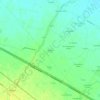
Vigolzone topographic map

Click on the map to display elevation.

About this map

Name: Vigolzone topographic map, elevation, terrain.

Location: Vigolzone, Piacenza, Emilia-Romagna, 29020, Italy (44.83232 9.56899 44.94816 9.71642)

Average elevation: 235 m

Minimum elevation: 100 m

Maximum elevation: 652 m

Other topographic maps

Click on a map to view its topography, its elevation and its terrain.

Casella

Italy > Emilia-Romagna > Piacenza > Bettola

Average elevation: 786 m

Pianazze

Italy > Emilia-Romagna > Piacenza > Vernasca

Average elevation: 347 m

Ramara

Italy > Emilia-Romagna > Piacenza > Cadeo

Average elevation: 57 m

Fiorano

Italy > Emilia-Romagna > Piacenza > Travo

Average elevation: 284 m

Dadomo

Italy > Emilia-Romagna > Piacenza > Vernasca

Average elevation: 690 m

Crocinito

Italy > Emilia-Romagna > Piacenza

Average elevation: 565 m

Bogli

Italy > Emilia-Romagna > Piacenza > Ottone

Average elevation: 1,188 m

Misano

Italy > Emilia-Romagna > Piacenza > Agazzano

Average elevation: 240 m

Sariano

Italy > Emilia-Romagna > Piacenza > Gropparello

Average elevation: 266 m

Capannette di Pej

Italy > Emilia-Romagna > Piacenza > Zerba

Average elevation: 1,312 m

Gear up for your next adventure:

🛏️Sleeping Bag - Warm and compact sleeping bags for outdoor camping
🥾Waterproof Hiking Shoes - Durable shoes for wet and rugged trails
🧊Insulated Water Bottle - Keeps drinks cold in summer and prevents freezing in winter
⛺Camping Tent - Weather-resistant tents suitable for 2 to 6 people
🔪Outdoor Multitool - Versatile tool for repairs and food prep in the wild

As an Amazon Associate, this site earns from qualifying purchases at no extra cost to you.