
Thank you for supporting this site ❤️
Make a donation
Make a donation
Gear up for your next adventure:
As an Amazon Associate, this site earns from qualifying purchases at no extra cost to you.
Misano topographic map
Click on the map to display elevation.
Thank you for supporting this site ❤️
Make a donation
Make a donation
Gear up for your next adventure:
As an Amazon Associate, this site earns from qualifying purchases at no extra cost to you.
About this map
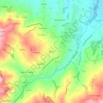
Name: Misano topographic map, elevation, terrain.
Location: Misano, Agazzano, Piacenza, Emilia-Romagna, Italy (44.91818 9.48911 44.95818 9.52911)
Average elevation: 240 m
Minimum elevation: 134 m
Maximum elevation: 390 m
Thank you for supporting this site ❤️
Make a donation
Make a donation
Gear up for your next adventure:
As an Amazon Associate, this site earns from qualifying purchases at no extra cost to you.