
Zaskovci topographic map
Interactive map
Click on the map to display elevation.
About this map
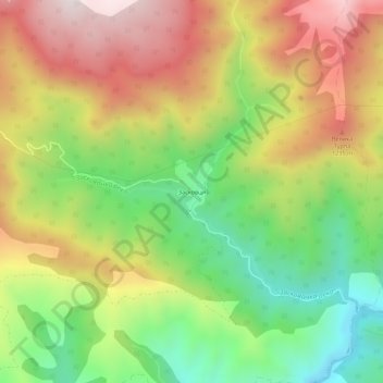
Name: Zaskovci topographic map, elevation, terrain.
Average elevation: 970 m
Minimum elevation: 569 m
Maximum elevation: 1,418 m
Other topographic maps
Click on a map to view its topography, its elevation and its terrain.
Stara planina
Serbia > Central Serbia > Pirot Administrative District > City of Pirot
Stara planina, City of Pirot, Pirot Administrative District, Central Serbia, Serbia
Average elevation: 1,806 m