
Kangema topographic map
Click on the map to display elevation.
About this map
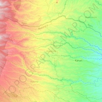
Name: Kangema topographic map, elevation, terrain.
Location: Kangema, Murang'a County, Central Kenya, 10202, Kenya (-0.73502 36.80860 -0.63413 37.11874)
Average elevation: 1,828 m
Minimum elevation: 1,292 m
Maximum elevation: 2,681 m
Other topographic maps
Click on a map to view its topography, its elevation and its terrain.